eXplorist 600 - Magellan GPS
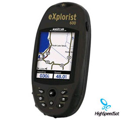
Magellan explorist600 satellite - has a 3-axis electronic compass, a barometric pressure indicator, altimeter and thermometer, plus the ability to expand your GPS mapping via a high-speed USB data port and unlimited secure digital (SD) card storage.![]()
Complete with 8 MB built-in mapping and unlimited flash-memory expansion, Magellan® eXplorist 600 is one of the first handheld GPS receivers to deliver PC-like file management, rechargeable lithium-ion batteries, and a PC application designed specifically for transferring geocache information from the Internet to the eXplorist in case you want to participate in the popular Web-based outdoor activity called geocaching (essentially a treasure hunt where the challenge isn't finding the treasure, it's getting to it).
The eXplorist 600 is an ideal GPS guidance tool--both in the city and in the country. It's the first in its class to deliver unlimited SD card memory expansion through a built-in Secure Digital memory card reader/writer. The handheld also provides unlimited storage of waypoints, routes, and track logs via SD card. Any available memory can be used to store whatever you want--a refreshing change from those receivers with fixed and limited waypoint, route, and track-log storage.
Magellan eXplorist 600
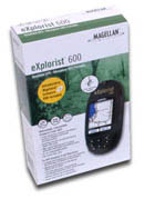
device in the box ![]()
The exclusive PC-style file-management feature lets you create multiple files, folders, and directories so you can store and navigate information in a PC-like structure. Also a first: the receiver gives you the ability to calculate an area and perimeter simply by marking points on the map screen.
Magellan geocaching manager software greatly simplifies geocaching (one of the fastest-growing GPS applications) so you no longer need to print information from a Web site only to have to manually enter the GPS coordinates into your receiver. Instead, you can load that information to your eXplorist so its accessible where it's needed most--to guide you right to cache treasures.
A high-speed USB data port lets you upload geocache coordinates and optional maps. Other features include a color transflective TFT screen, a barometer, an altimeter, a thermometer, and a 3-axis electronic compass (which eliminates the need to be in motion to get a direction heading).
Magellan explorist 600 Hand held GPS Receiver Review
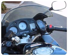
Magellan explorist 600 on a 2000
Honda motorcycle
![]()
Despite the eXplorist's wealth of features, it nevertheless resides in a compact, waterproof housing (IPX-7) at a weight of less than 4 ounces for fit-in-your-pocket convenience. The receiver boasts a large, 2.3-inch-diagonal backlit display; built-in maps of major roads, waterways, parks, and airports; the ability to calculate vertical profiles for elevations of roads, and trails; and a WAAS/EGNOS-enabled, 14-parallel-channel GPS receiver that delivers 3-meter accuracy with fast, reliable position fixes.
The Magellan eXplorist 600 is compatible with most Magellan MapSend software products (so you can add street detail, topographic data, marine navigation information, and other info), including MapSend Topo 3D USA, MapSend Topo Canada, MapSend Lakes USA, MapSend Worldwide Basemap, and MapSend DirectRoute, plus international titles.
The eXplorist 600 North America Handheld GPS is the perfect digital GPS tool for the true outdoorsman. Expand your GPS mapping via a high-speed USB data port and unlimited secure digital (SD) card storage. The Geocache Manager enables you to download caches directly to your eXplorist 600, while the 16-color display lets you see everything in brilliant color. Save up to 5 track log files, 20 routes and 500 points of interest on the internal memory. TrueFix technology provides superior accuracy and reliability, for freedom to explore without getting lost. Navigate your maps more easily with the intuitive keypad and joystick control. Pocket-sized, powerful and full of valuable features, your Magellan eXplorist 600 gives you real GPS that can guide you in full color on every outdoor adventure. Transfer map data from your PC through the USB data port Ready to go with no service or activation fees Unlimited SD Card expandability - add detailed street maps or topo charts with the optional Magellan MapSend software TrueFix GPS technology uses 14 parallel channels Download Geocache coordinates from Websites and manage travelling more effectively Area & perimeter calculation for the distance between two waypoints Monitor satellite status while tracking your position Rubber armored, impact resistant plastic for safe carrying on every adventure Rechargeable lithium-ion battery powers eXplorist for up to 14 hours Watertight - sealed to IPX-7 specifications Lightweight and portable - only 2.1 x 4.6 x 1.3
GPS eXplorist Specification
| Technical Specifications | |
|---|---|
| Physical: | |
| Case: | Rubber armored impact-resistant plastic, water-resistant seal |
| Base Map: | 16 MB built-in basemap of North America or Europe |
| Size: | 2.2" W x 4.7" H x 1.3" D |
| Weight: | 5.4 oz (164.4 g) - w/ battery |
| Display: | 2.25" diagonal, 16-color transflective TFT, high resolution (122 x 160), backlit |
| Memory: | 16 MB user data |
| Data Storage: | Unlimited / Secure Digital (SD) Card compatible |
| Antenna: | Built-in multidirectional patch |
| Keypad: | Nine direct-access keys |
| Joystick: | Eight-way easy scrolling w/ push-in instant enter |
| Operating Range: | 14 to 140°F (-10 to 60°C) |
| Performance: | |
| Receiver: | TrueFixTM 14 channels, WAAS/EGNOS |
| Acquisition Time: | Hot: 20 seconds, Cold: 60 seconds, Initial: 2 minutes |
| Update Rate: | Once per second |
| Accuracy: | 3 to 5 meters (10 - 16 feet) - WAAS/EGNOS, < 7 meters (15 feet) - GPS only |
| Velocity: | 0.1 knots (RMS) |
| Dynamics: | 6 g |
| Grids: | 75 including Lat/Lon, UTM, OSGB,MGRS, Finnish, German, Swedish, French, Irish, Swiss, USNG, User Grid (90 Max) |
| Languages: | English, French, German, Spanish, Italian, Swedish, Finnish, Portuguese, Dutch, Norwegian |
| Power: | |
| Source: | Li-Ion rechargeable battery 1300 MAH |
| Battery Life: | Up to 17 hours continuous use |
More Magellan GPS related links:
Magellan Products - Auto, handhelds, fitness, portable gps devices and accessories.How GPS works? - A lot of details about GPS system.
GPS satellites - NAVSTAR, satellite constellation, USCG Navigation Center and more!
GPS Blog - Comment the latest news and info from gps arena
GPS Satellite Forum - Raise a topic with other GPS enthusiasts about products, software, applications or adventures.
GPS Unit Documentation and Manuals
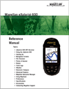
Click onthe thumbnail to download
Explorist Magelan 600 GPS
Data Sheet
(PDF, 3,290K)