List of Geostationary Satellites
A geostationary satellite is any satellite which is placed in a geostationary orbit. Satellites in geostationary orbit maintain a constant position relative to the surface of the Earth. ![]()
Deprecated: mysql_connect(): The mysql extension is deprecated and will be removed in the future: use mysqli or PDO instead in /hermes/bosnacweb07/bosnacweb07aa/b493/nf.highspeedsat/public_html/geostationary-satellites.php on line 71
| Longitude | Inclination | Name | Launch Date | Details Amended |
|---|---|---|---|---|
| 0.0°E | 0 | MSG-2 | 2005-12-21 | 2008-07-25 |
| 3°E | 2.7° | Telecom 2C | 1995-12-06 | 2008-07-24 |
| 352°E 8°W | 3.9° | Eutelsat Telecom 2A | 1991-12-16 | 2008-07-24 |
| 31.5°E | 0 | Sirius 2 | 1997-11-12 | 2008-08-06 |
| 5.0°E | 0 | Sirius 3 | 1998-10-05 | 2008-07-24 |
| 4.8°E | 0 | Sirius 4 | 2007-11-18 | 2008-07-24 |
| 4.6°E | 0 | Astra 1C | 1993-05-12 | 2008-07-24 |
| 7.0°E | 0 | Eutelsat W3A | 2004-03-16 | 2008-07-23 |
| 9.0°E | 0 | Eurobird 9 | 1996-11-21 | 2008-07-24 |
| 9.1°E | 0 | Express 4A | 2002-06-10 | 2008-07-23 |
| 10.0°E | 0 | Eutelsat W1 | 2002-11-20 | 2008-07-23 |
| 13°E | 0 | Hotbird 1 | 1995-03-29 | 2008-07-24 |
| 13°E | 0 | Eurobird 10 | 1997-09-02 | 2008-07-24 |
| 13°E | 0 | Hotbird 6 | 2002-08-21 | 2008-07-23 |
| 13°E | 0 | Hotbird 7A | 2006-11-03 | 2008-07-24 |
| 16°E | 0 | Eutelsat W2 | 1998-10-05 | 2008-08-01 |
| 16.1°E | 0.7° | SICRAL 1 | 2001-02-07 | 2008-08-01 |
| 19.2°E | 0 | Astra 1B | 1991-03-02 | 2008-07-23 |
| 19.2°E | 0 | Astra 1F | 1996-04-08 | 2008-08-01 |
| 19.2°E | 0 | Astra 1G | 1997-12-02 | 2008-07-23 |
| 19.2°E | 0 | Astra 1H | 1999-06-18 | 2008-07-23 |
| 19.2°E | 0 | Astra 1KR | 2006-04-20 | 2008-07-23 |
| 19.2°E | 0 | Astra 1L | 2007-05-04 | 2008-07-23 |
| 21°E | 0 | AfriStar | 1999-01-01 | 2008-07-23 |
| 21.4°E | 4° | Artemis | 1999-01-01 | 2008-07-23 |
| 21.5°E | 0 | Eutelsat W6 [] | 1999-01-01 | 2008-07-23 |
| 23.5°E | 0 | Astra 1E | 1995-10-19 | 2008-07-23 |
| 23.5°E | 0 | Astra 3A | 2002-03-29 | 2008-07-23 |
| 25°E | 0.4° | Inmarsat 3-F5 | 1999-01-01 | 2008-07-23 |
| 26°E | 0 | Arabsat BADR 3 | 1999-01-01 | 2008-07-23 |
| 26°E | 0 | Arabsat BADR-C | 1999-01-01 | 2008-07-23 |
| 26°E | 0 | Arabsat BADR-4 | 1999-01-01 | 2008-07-23 |
| 28.2°E | 0 | Astra 2A | 1998-08-30 | 2008-07-23 |
| 28.2°E | 0 | SES New Skies Astra 2B | 1999-01-01 | 2008-07-23 |
| 28.2°E | 0 | Astra 2C | 2001-06-16 | 2008-07-23 |
| 28.2°E | 0 | Astra 2D | 2000-12-19 | 2008-07-23 |
| 28.5°E | 0 | Eutelsat EurobirdTM 1 | 1999-01-01 | 2008-07-23 |
| 29°E | 0 | XTAR-EUR Hispdesat Spain (govt-mil) | 1999-01-01 | 2008-07-23 |
| 30°E | 0 | Astra 1D | 1999-01-01 | 2008-07-23 |
| 30.5°E | 0 | Arabsat 2B | 1999-01-01 | 2008-07-23 |
| 33°E | 0 | Intelsat IS 802 | 1999-01-01 | 2008-07-23 |
| 33°E | 0 | Eutelsat Euro-Bird 3 E-Bird | 1999-01-01 | 2008-07-23 |
| 36.0°E | 0 | Eutelsat SESAT 1 | 1999-01-01 | 2008-07-23 |
| 36.0°E | 0 | RSCC Eutelsat W4 | 1999-01-01 | 2008-07-23 |
| 38°E | 0 | Palapa C1 / Hughes HGS 3 / Anatolia 1 / IS HGS-3 / Paksat 1 | 1999-01-01 | 2008-07-23 |
| 38.1°E | 0 | Palapa C1 | 1999-01-01 | 2008-07-23 |
| 39°E | 0 | Hellas SAT-2 | 1999-01-01 | 2008-07-23 |
| 40°E | 0 | RSCC Express A1R | 1999-01-01 | 2008-07-23 |
| 40°E | 0 | RSCC | 1999-01-01 | 2008-07-23 |
| 40.0°E | 0 | Express-AM1 | 2004-10-30 | 2008-07-23 |
| 42.5°E | 0 | Palapa 6 B2R | 1999-01-01 | 2008-07-23 |
| 42.0°E | 0 | Turksat 2A | 1999-01-01 | 2008-07-23 |
| 42.0°E | 0 | Turksat 1C | 1999-01-01 | 2008-07-23 |
| 42.5°E | 2.5° | Palapa B2R | 1999-01-01 | 2008-07-23 |
| 42.5°E | 0 | NigComsat 1 | 1999-01-01 | 2008-07-23 |
| 44.1°E | 4.8° | Thuraya 1 | 1999-01-01 | 2008-07-23 |
| 44.1°E | 4.0° | Thuraya 2 | 1999-01-01 | 2008-07-23 |
| 45.0°E | 0 | Europestar 1 = IS PAS 12 = Intelsat 12 IS-12 | 1999-01-01 | 2008-07-23 |
| 45°E | 0 | Measat 1 => Africasat 1 | 1999-01-01 | 2008-07-23 |
| 47°E | 0 | Telecom 2B | 1999-01-01 | 2008-07-23 |
| 47°E | 0 | Syracuse 3A (fr-mil) | 1999-01-01 | 2008-07-23 |
| 47.5°E | 0 | Intelsat IS 601 | 1999-01-01 | 2008-07-23 |
| 48°E | 0 | GSAT 2 | 1999-01-01 | 2008-07-23 |
| 48.5°E | 5.1° | Eutelsat II F-2 | 1999-01-01 | 2008-07-23 |
| 49°E | 0.6° | Raduga 1-5 | 1999-01-01 | 2008-07-23 |
| 49°E | 0 | Yamal 200 202 SC-2 | 1999-01-01 | 2008-07-23 |
| 49°E ? | 0 | Yamal 101 | 1999-01-01 | 2008-07-23 |
| 50°E | 0 | GORIZONT 38 | 1999-01-01 | 2008-07-23 |
| 50.25°E | 0 | Intelsat IS 706 | 1999-01-01 | 2008-07-23 |
| 51.2°E | 0.7° | Galaxy 5 | 1999-01-01 | 2008-07-23 |
| 52.9°E | 3.9° | GORIZONT 32 | 1999-01-01 | 2008-07-23 |
| 53°E | 0 | RSCC | 1999-01-01 | 2008-07-23 |
| 53.0°E | 0 | "SESAT 2 | 2003-12-28 | 2008-07-23 |
| 53°E | 0 | Skynet 5B | 1999-01-01 | 2008-07-23 |
| 54.85°E | 0 | Intelsat IS 702 | 1999-01-01 | 2008-07-23 |
| 55°E | 0 | Insat 3E | 1999-01-01 | 2008-07-23 |
| 56°E | 0 | RSCC | 1999-01-01 | 2008-07-23 |
| 56.0°E | 0 | Bonum 1 | 1998-11-22 | 2008-07-23 |
| 57°E | 0 | NSS 703 | 1999-01-01 | 2008-07-23 |
| 60.0°E | 0 | Intelsat IS 904 | 1999-01-01 | 2008-07-23 |
| 62.0°E | 0 | Intelsat IS 902 | 1999-01-01 | 2008-07-23 |
| 63.9°E | 0 | Inmarsat-3 F1 | 1999-01-01 | 2008-07-23 |
| 64°E | 0 | Inmarsat-4 F1 | 1999-01-01 | 2008-07-23 |
| 64.1°E | 0 | Intelsat IS 906 | 1999-01-01 | 2008-07-23 |
| 66°E | 0 | Meteosat 6 | 1999-01-01 | 2008-07-23 |
| 66°E | 0 | Intelsat IS 704 | 1999-01-01 | 2008-07-23 |
| 68.7°E | 0 | IS PAS-7 = Intelsat 7 IS-7 | 1999-01-01 | 2008-07-23 |
| 68.5°E | 0 | IS PAS-10 = Intelsat 10 IS-10 | 1999-01-01 | 2008-07-23 |
| 70.5°E | 0 | Eutelsat W5 | 2002-11-20 | 2008-07-23 |
| 72°E | 3.9° | ELECTRO GOMS | 1999-01-01 | 2008-07-23 |
| 72°E | 0 | IS PAS-4 = Intelsat 4 IS-4 | 1999-01-01 | 2008-07-23 |
| 72.8°E | 2.2° | Luch 1 | 1999-01-01 | 2008-07-23 |
| 74°E | 0 | Edusat | 1999-01-01 | 2008-07-23 |
| 74°E | 0 | Insat 3C | 1999-01-01 | 2008-07-23 |
| 74.2°E | 4.3° | Insat 1D | 1999-01-01 | 2008-07-23 |
| 75°E | 0 | AM1 > | 1999-01-01 | 2008-07-23 |
| 76.5°E | 0 | APSTAR 2R / Telstar 10 | 1999-01-01 | 2008-07-23 |
| 78.5°E | 0 | Thaicom 2 | 1999-01-01 | 2008-07-23 |
| 78.5°E | 0 | Thaicom 3 deorbited 2 Oct 06 | 1999-01-01 | 2008-07-23 |
| 78.5°E | 0 | Thaicom 5 | 1999-01-01 | 2008-07-23 |
| 79.9°E | 0.8° | Cosmos 2350 | 1999-01-01 | 2008-07-23 |
| 80°E | 0 | RSCC Express AM-2 | 1999-01-01 | 2008-07-23 |
| 80°E | 0 | Express 2A | 1999-01-01 | 2008-07-23 |
| 80°E | 0 | RSCC Express 6A ? | 1999-01-01 | 2008-07-23 |
| 80.3°E Cosmos | 0 | Geizer 2371 | 1999-01-01 | 2008-07-23 |
| 80.3°E | 0 | Beidou 1B | 1999-01-01 | 2008-07-23 |
| 83°E | 0 | Insat 3B | 1999-01-01 | 2008-07-23 |
| 83°E | 0 | Insat 4A | 1999-01-01 | 2008-07-23 |
| 83°E | 0 | Insat 2E = Intelsat IS APR-1 | 1999-01-01 | 2008-07-23 |
| 84.7°E | 7.3° | TDRS 3 | 1999-01-01 | 2008-07-23 |
| 85°E | 0 | Intelsat IS 709 | 1999-01-01 | 2008-07-23 |
| 85.5°E | 5° | FY-2 | 1999-01-01 | 2008-07-23 |
| 86.5°E | 0 | Fengyun-2 Meto | 1999-01-01 | 2008-07-23 |
| 87.5°E | 0 | Chin1/Zhng1? | 1999-01-01 | 2008-07-23 |
| 87.6°E | 0 | Sinosat Chinastar1 98-33 | 1999-01-01 | 2008-07-23 |
| 88°E | 0 | ST 1 | 1999-01-01 | 2008-07-23 |
| 89.8°E | 0 | Yamal 1 02 | 1999-01-01 | 2008-07-23 |
| 90°E | 0 | Yamal 201 | 1999-01-01 | 2008-07-23 |
| 90.7°E | 0 | DRTS | 1999-01-01 | 2008-07-23 |
| 91.5°E | 0 | Measat 3 | 1999-01-01 | 2008-07-23 |
| 92.2E solar arra | 0 | Sinosat 2 = Xinnuo 2 | 1999-01-01 | 2008-07-23 |
| 93.5°E | 0 | INSAT 4B | 1999-01-01 | 2008-07-23 |
| 95°E | 0 | NSS 6 | 1999-01-01 | 2008-07-23 |
| 96.5°E | 5.7° | Gorizont 28 | 1999-01-01 | 2008-07-23 |
| 96.5°E | 0 | RSCC | 1999-01-01 | 2008-07-23 |
| 98°E | 0 | Zhongxing 22 | 1999-01-01 | 2008-07-23 |
| 99°E | 2.5° | RSCC Ekran M 21 M18 | 1999-01-01 | 2008-07-23 |
| 100°E | 8° | Leasat 5 > PAS Leasat 5 > IS Leasat 5 | 1999-01-01 | 2008-07-23 |
| 100.5°E | 0 | Asiasat 2 | 1999-01-01 | 2008-07-23 |
| 103°E | 0 | KazSat 1 | 1999-01-01 | 2008-07-23 |
| 103°E | 0 | RSCC Express A2 | 1999-01-01 | 2008-07-23 |
| 103°E | 0 | RSCC Gorizont 40 | 1999-01-01 | 2008-07-23 |
| 104.5°E | 0.2° | FengYun 2C | 1999-01-01 | 2008-07-23 |
| 105°E | 0 | AsiaStar | 1999-01-01 | 2008-07-23 |
| 105.5°E | 0 | Asiasat 3S | 1999-01-01 | 2008-07-23 |
| 107.5°E | 0.3° | Indostar/Cakrawarta 1 | 1999-01-01 | 2008-07-23 |
| 108°E | 0 | Telekom 1 | 1999-01-01 | 2008-07-23 |
| 108.2°E | 0 | NSS-11 = AMC SES Americom AAP-1 = GE 1A | 1999-01-01 | 2008-07-23 |
| 109°E | 2.4° | Inmarsat 2F4 | 1999-01-01 | 2008-07-23 |
| 109.7°E | 0 | B-SAT 1A | 1999-01-01 | 2008-07-23 |
| 109.9°E | 0 | BS-3N | 1999-01-01 | 2008-07-23 |
| 109.7°E | 0.4° | B-SAT 1B | 1999-01-01 | 2008-07-23 |
| 109.9°E | 0 | B-SAT 2A | 1999-01-01 | 2008-07-23 |
| 109.9°E | 0 | B-SAT 2C | 1999-01-01 | 2008-07-23 |
| 110°E | 0 | JCSAT-110 NSAT-110 | 1999-01-01 | 2008-07-23 |
| 110.5°E | 0 | IS APR-2 (Sinosat 1) | 1999-01-01 | 2008-07-23 |
| 110.6°E | 0 | Beidou 1C | 1999-01-01 | 2008-07-23 |
| 112°E | 0 | Mugunghwa 2 | 1999-01-01 | 2008-07-23 |
| 112.9°E | 0 | Koreasat 2 | 1999-01-01 | 2008-07-23 |
| 113°E | 0 | Palapa C2 | 1999-01-01 | 2008-07-23 |
| 116°E | 0 | Koreasat 3 | 1999-01-01 | 2008-07-23 |
| 118°E | 0 | Palapa 7 B4 | 1999-01-01 | 2008-07-23 |
| 119.5° | 0 | Thaicom 4 | 1999-01-01 | 2008-07-23 |
| 120°E | 0 | Thaicom 1A | 1999-01-01 | 2008-07-23 |
| 122.2°E | 0 | Asiasat 4 | 1999-01-01 | 2008-07-23 |
| 123°E | 1.4° | Garuda 1 | 1999-01-01 | 2008-07-23 |
| 123.4°E | 0.9° | Fengyun 2B | 1999-01-01 | 2008-07-23 |
| 124°E | 0 | JCSAT 4A / 6 | 1999-01-01 | 2008-07-23 |
| 125°E | 0 | DFH 3F2 | 1999-01-01 | 2008-07-23 |
| 125°E | 0 | Zhongxing 6 | 1999-01-01 | 2008-07-23 |
| 125°E | 0 | Zhongxing 8 | 1999-01-01 | 2008-07-23 |
| 127.5°E | 0 | JCSAT 4 ( 1A and R ) | 1999-01-01 | 2008-07-23 |
| 128°E | 0 | JCSAT 3 | 1999-01-01 | 2008-07-23 |
| 130°E | 0 | APSTAR A1 | 1999-01-01 | 2008-07-23 |
| 132°E | 0 | N-STAR-A | 1999-01-01 | 2008-07-23 |
| 132°E | 0 | JCSAT 9 | 1999-01-01 | 2008-07-23 |
| 132°E | 0 | CS-3A | 1999-01-01 | 2008-07-23 |
| 134°E | 0 | APSTAR 6 | 1999-01-01 | 2008-07-23 |
| 136°E | 0 | N-STAR-B | 1999-01-01 | 2008-07-23 |
| 136°E | 0 | N-STAR-3-C | 1999-01-01 | 2008-07-23 |
| 138°E | 0 | APSTAR 1 | 1999-01-01 | 2008-07-23 |
| 138°E | 0 | APSTAR 5 | 1999-01-01 | 2008-07-23 |
| 140°E | 0 | RSCC Express AM-3 | 1999-01-01 | 2008-07-23 |
| 140°E | 0 | RSCC Gorizont 36 | 1999-01-01 | 2008-07-23 |
| 140°E | 0 | RSCC Gorizont 43 | 1999-01-01 | 2008-07-23 |
| 140.3°E | 6.7° | Gorizont 25 | 1999-01-01 | 2008-07-23 |
| 139.9°E | 1.9° | Himwari/GMS5 | 1999-01-01 | 2008-07-23 |
| 140°E | 0 | MSAT 1-R (Meteo/Aviation) Himawari 6 | 1999-01-01 | 2008-07-23 |
| 140.0°E | 0 | Beidou 1 | 1999-01-01 | 2008-07-23 |
| 142.5°E | 0 | GORIZONT 42 | 1999-01-01 | 2008-07-23 |
| 142.1°E | 4.3° | Rimsat Gz30 | 1999-01-01 | 2008-07-23 |
| 143°E | 0 | Kizuna | 1999-01-01 | 2008-07-23 |
| 144°E | 0 | Superbird C | 1999-01-01 | 2008-07-23 |
| 144°E | 0 | MB-SAT | 1999-01-01 | 2008-07-23 |
| 144.6°E | 1° | Gorizont 33 | 1999-01-01 | 2008-07-23 |
| 145°E | 0 | RSCC Gorizont 45 | 1999-01-01 | 2008-07-23 |
| 146°E | 0 | Agila 2/Mabuhay | 1999-01-01 | 2008-07-23 |
| 146°E | 0 | ETS-8 = Kiku-8 | 1999-01-01 | 2008-07-23 |
| 147°E | 0 | MPSC 2 | 1999-01-01 | 2008-07-23 |
| 148°E | 0 | Measat 2 | 1999-01-01 | 2008-07-23 |
| 150°E | 0 | JCSAT 1B | 1999-01-01 | 2008-07-23 |
| 164.0°E | 0 | Optus B3 | 1994-08-27 | 2008-07-23 |
| 152°E | 0 | Optus D2 | 1999-01-01 | 2008-07-23 |
| 154°E | 0 | JCSAT 2A / 8 | 1999-01-01 | 2008-07-23 |
| 155.7°E | 4.2° | Leasat 5 | 1999-01-01 | 2008-07-23 |
| 156°E | 0 | Optus C1 | 1999-01-01 | 2008-07-23 |
| 157°E | 4° | Intelsat IS 602 | 1999-01-01 | 2008-07-23 |
| 158°E | 0 | Superbird A1 | 1999-01-01 | 2008-07-23 |
| 160°E | 0 | Optus Aussat B1 | 1999-01-01 | 2008-07-23 |
| 160°E | 0 | Optus Aussat D1 | 1999-01-01 | 2008-07-23 |
| 162°E | 0 | Superbird 4 B2 | 1999-01-01 | 2008-07-23 |
| 164°E | 0 | GOES-East GOES-8 | 1999-01-01 | 2008-07-23 |
| 166°E | 0 | IS PAS 8 = Intelsat 8 IS-8 | 1999-01-01 | 2008-07-23 |
| 169°E | 0 | IS PAS 2 = Intelsat 2 IS-2 | 1999-01-01 | 2008-07-23 |
| 172°E | 0 | AMC 23 > | 1999-01-01 | 2008-07-23 |
| 172.0°E | 0 | GE-23 [AMC-23] | 2005-12-29 | 2008-07-23 |
| 174°E inc | 0 | Intelsat IS 605 | 1999-01-01 | 2008-07-23 |
| 178°E | 0 | Inmarsat 3 F3 | 1999-01-01 | 2008-07-23 |
| 180°E | 0 | Intelsat IS 701 | 1999-01-01 | 2008-07-23 |
| 183°E 177°W | 0 | NSS 5 | 1999-01-01 | 2008-07-23 |
| 189°E 171°W | 6.3° | TDRS 8 | 1999-01-01 | 2008-07-23 |
| 205.2°E | 4.2° | Eutelsat II F-4 | 1999-01-01 | 2008-07-23 |
| 210°E 150°W | 0 | TDRS 10 | 1999-01-01 | 2008-07-23 |
| 211.9°E 148.1°W | 0 | Echostar 1 | 1999-01-01 | 2008-07-23 |
| 212.1°E 147.9°W | 0 | Echostar 2 | 1999-01-01 | 2008-07-23 |
| 214.5°E 145.5°W | 4.7° | Express 1 | 1999-01-01 | 2008-07-23 |
| 221°E 139°W | 0 | GE-8 AMC 8 | 1999-01-01 | 2008-07-23 |
| 223°E 137°W | 0 | GE-7 AMC-7 | 1999-01-01 | 2008-07-23 |
| 224.3°E 135.7 | 0 | GOES-Spare GOES-11 | 1999-01-01 | 2008-07-23 |
| 225°E 135°W | 0 | AMC 10 | 1999-01-01 | 2008-07-23 |
| ? | 0 | Intelsat Galaxy 15 | 1999-01-01 | 2008-07-23 |
| 229°E 131°W | 0 | SES AMC-11 | 1999-01-01 | 2008-07-23 |
| 231°E 129°W | 0 | Telstar 7 = Intelsat IA-7 = Intelsat Galaxy 27 G-27 | 1999-01-01 | 2008-07-23 |
| 231.1°E 128.9°W | 0 | Echostar 5 | 1999-01-01 | 2008-07-23 |
| 233°E 127°W | 0 | Horizons 1 = Intelsat Horizons 1 | 1999-01-01 | 2008-07-23 |
| 233°E 127°W | 0 | Intelsat Galaxy 13 | 1999-01-01 | 2008-07-23 |
| 235°E 125°W | 0 | Intelsat Galaxy 14 | 1999-01-01 | 2008-07-23 |
| 269°E 125°W | 0 | Galaxy 12 | 1999-01-01 | 2008-07-23 |
| 237°E 123°W | 0 | Intelsat Galaxy 10R | 1999-01-01 | 2008-07-23 |
| 239°E 121°W | 0 | EchoStar 9 = Telstar 13 = IS IA-13 = Intelsat Galaxy 23 G-23 | 1999-01-01 | 2008-07-23 |
| 240°E 120°W | 0 | Telstar 303 | 1999-01-01 | 2008-07-23 |
| 240.8°E 119.2°W | 0 | DirecTV 7S | 1999-01-01 | 2008-07-23 |
| 240°E 119°W | 0 | Echostar 2 | 1999-01-01 | 2008-07-23 |
| 241°E 119°W | 0 | Echostar 5 | 1999-01-01 | 2008-07-23 |
| 241.1°E 118.9°W | 0 | Echostar 7 | 1999-01-01 | 2008-07-23 |
| 241°E 119°W | 0 | AMC 16 | 1999-01-01 | 2008-07-23 |
| 241.3°E 118.3°W | 0 | Anik F-3 | 1999-01-01 | 2008-07-23 |
| 243.2°E 116.8°W | 0 | Satmex 5 | 1999-01-01 | 2008-07-23 |
| 275°E 115°W | 0 | XM-1 | 1999-01-01 | 2008-07-23 |
| 274°E 86°W | 0 | XM-2 | 1999-01-01 | 2008-07-23 |
| 245°E 85°W | 0 | XM-4 | 1999-01-01 | 2008-07-23 |
| 244.1°E 114.9°W | 0 | Solidaridad 2 | 1999-01-01 | 2008-07-23 |
| 247°E 113°W | 0 | Satmex 6 | 1999-01-01 | 2008-07-23 |
| 247.3°E 112.7°W | 0 | Cosmos 2282 i=2.6 | 1999-01-01 | 2008-07-23 |
| 248.9°E 111.1°W | 0 | Wildblue 1 | 1999-01-01 | 2008-07-23 |
| 248.9°E 111.1°W | 0 | Anik F-2 (Wildblue) | 1999-01-01 | 2008-07-23 |
| 249.8°E 110.1°W | 0 | Echostar 6 | 1999-01-01 | 2008-07-23 |
| 249°E 110°W | 0 | Echostar 10 | 1999-01-01 | 2008-07-23 |
| 250°E 110°W | 0 | "Tempo 2 | 1999-01-01 | 2008-07-23 |
| 250°E 110°W | 0 | Echostar 8 | 1999-01-01 | 2008-07-23 |
| 250°E 110°W | 0 | Direct TV 5 | 1999-01-01 | 2008-07-23 |
| 250.8°E 109.2°W | 0 | Anik E-1 | 1999-01-01 | 2008-07-23 |
| 250.9°E 109.1°W | 0 | Solidaridad 1 | 1999-01-01 | 2008-07-23 |
| 252.7°E 107.3°W | 0 | Anik F-1 | 1999-01-01 | 2008-07-23 |
| 253.5°E 106.5°W | 0 | MSAT M1 | 1999-01-01 | 2008-07-23 |
| 254.8°E 105.2°W | 0 | ACTS i=3.9 | 1999-01-01 | 2008-07-23 |
| 255°E 105°W | 0 | AMC-18 | 1999-01-01 | 2008-07-23 |
| 255°E 105°W | 0 | Satcom C4 | 1999-01-01 | 2008-07-23 |
| 255°E 105°W | 0 | AMC 18 due for launch | 1999-01-01 | 2008-07-23 |
| 255°E 105°W | 0 | AMC 15 GE 15 | 1999-01-01 | 2008-07-23 |
| 255°E 105°W | 0 | Gstar 4 | 1999-01-01 | 2008-07-23 |
| 256.2°E 103.8°W | 5.4° | Galaxy 6 | 1990-10-12 | 2008-07-24 |
| 256.3°E 103.7W | 0 | GOES-Spare GOES-9 | 1999-01-01 | 2008-07-23 |
| 257°E 103°W | 0 | GE-1 AMC-1 | 1999-01-01 | 2008-07-23 |
| drifting | 0 | Spaceway F1 | 1999-01-01 | 2008-07-23 |
| 258.9°E 101.1°W | 0 | DirecTV 4S | 1999-01-01 | 2008-07-23 |
| 259.0°E 101°W | 0 | GE 4 AMC 4 | 1999-01-01 | 2008-07-23 |
| 259°E 101°W | 0 | DirecTV 8 | 1999-01-01 | 2008-07-23 |
| 259°E 101°W | 0 | DirecTV 9S | 1999-01-01 | 2008-07-23 |
| ? | 0 | AMSC 1 | 1999-01-01 | 2008-07-23 |
| 259.4°E 100.6°W | 0 | DirecTV 2/DBS 2 | 1999-01-01 | 2008-07-23 |
| 261°E 99°W | 0 | Intelsat Galaxy 16 | 1999-01-01 | 2008-07-23 |
| 261°E 99°W | 0 | IS Galaxy 4R | 1999-01-01 | 2008-07-23 |
| 262°E 98°W | 0 | Inmarsat 2F2 | 1999-01-01 | 2008-07-23 |
| 263°E | 0 | Telstar 5 = Intelsat IS IA-5 = Intelsat Galaxy 25 G-25 | 1999-01-01 | 2008-07-23 |
| 97°W | 0 | 1999-01-01 | 2008-07-23 | |
| 265°E 95°W | 0 | Spaceway 3 | 1999-01-01 | 2008-07-23 |
| 265°E 95°W | 0 | Intelsat Galaxy G-3C | 1999-01-01 | 2008-07-23 |
| 266.6°E 93.4°W | 0 | DirecTV 5 | 1999-01-01 | 2008-07-23 |
| 267°E 93°W | 0 | Telstar 6 = Intelsat IS IA-6 =Intelsat Galaxy 26 G-26 | 1999-01-01 | 2008-07-23 |
| 268°E 92°W | 0 | Brazilsat B4 | 1999-01-01 | 2008-07-23 |
| 268°E 92°W | 0 | DBS-1 DirecTV-1 1993-78a | 1999-01-01 | 2008-07-23 |
| 269°E 91°W | 0 | Telesat Nimiq 1 | 1999-01-01 | 2008-07-23 |
| 268.8°E 91.2°W | 0 | DBS 3 DirecTV 3 Nimiq 2i Nimiq 3 | 1999-01-01 | 2008-07-23 |
| 269°E 91°W | 0 | Intelsat Galaxy G-17 | 1999-01-01 | 2008-07-23 |
| 269°E 91°W | 0 | Intelsat Galaxy G-11 | 1999-01-01 | 2008-07-23 |
| 270°E 90°W | 0 | GOES 13 | 1999-01-01 | 2008-07-23 |
| 271°E 89°W | 0 | Telstar 8 = Intelsat IA-8 = Intelsat Galaxy 28 G-28 | 1999-01-01 | 2008-07-23 |
| 273°E 87°W | 0 | GE-3 AMC-3 | 1999-01-01 | 2008-07-23 |
| 274.9°E 85.1°W | 0 | XM-3 | 1999-01-01 | 2008-07-23 |
| ? | 0 | GE-2 AMC-2 | 1999-01-01 | 2008-07-23 |
| 276°E 84°W | 0 | Brazilsat B3 | 1999-01-01 | 2008-07-23 |
| 277°E 83°W | 0 | AMC 9 GE 12 | 1999-01-01 | 2008-07-23 |
| 278°E 82°W | 0 | Telesat Nimiq 2 | 1999-01-01 | 2008-07-23 |
| 279°E 81°W | 0 | IS SBS 6 | 1999-01-01 | 2008-07-23 |
| 279°E 81°W | 0 | Anik E-2 | 1999-01-01 | 2008-07-23 |
| 279°E 81°W | 0 | Intelsat Galaxy 9 | 1999-01-01 | 2008-07-23 |
| 281°E 79°W | 0.9° | Satcom C3 | 1999-01-01 | 2008-07-23 |
| 281°E 79°W | 0 | GE 5 AMC 5 | 1999-01-01 | 2008-07-23 |
| 283°E 77°W | 1.1° | Echostar 4 | 1999-01-01 | 2008-07-23 |
| 284°E 76°W | 0.3° | GOES-East GOES-12 | 1999-01-01 | 2008-07-23 |
| 285°E 75°W | 0 | Brazilsat B1 | 1999-01-01 | 2008-07-23 |
| 286°E 74°W | 0 | Galaxy 3R | 1999-01-01 | 2008-07-23 |
| 286°E 74°W | 0 | JCSAT Intelsat Horizons 2 | 1999-01-01 | 2008-07-23 |
| 286°E 74°W | 0 | Intelsat Galaxy 17 | 1999-01-01 | 2008-07-23 |
| 287°E 73°W | 0 | DirecTV 1R | 1999-01-01 | 2008-07-23 |
| 287.5°E 72.5°W | 0 | "Tempo 1 | 1999-01-01 | 2008-07-23 |
| 288°E 72°W | 0 | GE 6 AMC 6 | 1999-01-01 | 2008-07-23 |
| 288.2°E 71.8°W | 0 | Nahuel 1A | 1999-01-01 | 2008-07-23 |
| 295°E 65°W | 0 | StarOne C-1 | 1999-01-01 | 2008-07-23 |
| 295°E 65°W | 0 | Brazilsat B2 | 1999-01-01 | 2008-07-23 |
| 297°E 63°W | 0 | Estrela do Sul - Telstar 14 | 1999-01-01 | 2008-07-23 |
| 297°E 63°W | 0 | TDRS -9 | 1999-01-01 | 2008-07-23 |
| 298.5°E 61.5°W | 0 | Rainbow 1 | 1999-01-01 | 2008-07-23 |
| 298.5°E 61.5°W | 0 | Echostar 3 | 1999-01-01 | 2008-07-23 |
| 299°E 61°W | 0 | Amazonas Hispasat | 1999-01-01 | 2008-07-23 |
| 300°E 60°W | 0 | GOES-10 | 1999-01-01 | 2008-07-23 |
| 302°E 58°W | 0 | IS PAS 9 = Intelsat 9 IS-9 | 1999-01-01 | 2008-07-23 |
| 304.5°E 55.5°W | 0 | Intelsat IS 805 | 1999-01-01 | 2008-07-23 |
| 306°E 54°W | 0 | Inmarsat 3-F4 | 1999-01-01 | 2008-07-23 |
| 307°E 53°W | 0 | Intelsat IS 707 | 1999-01-01 | 2008-07-23 |
| 307°E 53°W | 0 | Inmarsat 4 F-2 | 1999-01-01 | 2008-07-23 |
| 310°E 50°W | 0 | Intelsat IS 705 | 1999-01-01 | 2008-07-23 |
| 313°E 47°W | 0 | TDRS 6 i=3.6 | 1999-01-01 | 2008-07-23 |
| 313°E 41°W | 0 | TDRS 4 i=5.2 | 1999-01-01 | 2008-07-23 |
| 315°E 45°W | 0 | IS PAS 1R = Intelsat 1R IS-1R | 1999-01-01 | 2008-07-23 |
| 317°E 43°W | 0 | IS PAS 3R = Intelsat 3R IS-3R | 1999-01-01 | 2008-07-23 |
| 317°E 43°W | 0 | Intelsat 11 = IS 11 | 1999-01-01 | 2008-07-23 |
| 319.5°E 40.5°W | 0 | NewSkies NSS-806 | 1999-01-01 | 2008-07-23 |
| 322.5°E 37.5°W | 0 | NSS-10 = AMC 12 = SES Astra 4A = Worldsat 2 | 1999-01-01 | 2008-07-23 |
| 322.5°E 37.5°W | 0 | Satcom C1 | 1999-01-01 | 2008-07-23 |
| ? | 0 | Telstar 11 Orion 1 | 1999-01-01 | 2008-07-23 |
| 325.5°E 34.5°W | 0 | Intelsat IS 903 | 1999-01-01 | 2008-07-23 |
| 328.5°E 31.5°W | 0 | Intelsat IS 801 | 1999-01-01 | 2008-07-23 |
| 329.8°E 30.2°W | 0 | Hispasat 1C | 1999-01-01 | 2008-07-23 |
| 330.0°E 30.0°W | 0 | Spainsat Hisdesat(mil) | 1999-01-01 | 2008-07-23 |
| 330.1°E 29.9°W | 0 | Hispasat 1D | 1999-01-01 | 2008-07-23 |
| 332.5°E 27.5°W | 0 | Intelsat IS 907 | 1999-01-01 | 2008-07-23 |
| 335.5°E 24.5°W | 0 | Intelsat IS 905 | 1999-01-01 | 2008-07-23 |
| 338°E 22°W | 0 | NewSkies | 1999-01-01 | 2008-07-23 |
| 338.0°E 22.0°W | 0 | NSS-7 | 1999-01-01 | 2008-07-23 |
| 340.0E 20.0W inc | 0 | Intelsat IS 603 | 1999-01-01 | 2008-07-23 |
| 342°E 18°W | 0 | Intelsat IS 901 | 1999-01-01 | 2008-07-23 |
| 344.5°E 15.5°W | 0 | Inmarsat 3F2 | 1999-01-01 | 2008-07-23 |
| 344.7°E | 3.4° | DFS Kopernikus 3 | 1999-01-01 | 2008-07-23 |
| 345°E 15°W | 0 | Orion 2 | 1999-01-01 | 2008-07-23 |
| 345°E 15°W | 0 | Eutelsat Telstar 12 | 1999-01-01 | 2008-07-23 |
| 347.7°E 12.3°W | 1° | Eutelsat 2-F4 | 1999-01-01 | 2008-07-23 |
| 345.6°E 14.4°W | 6° | RSCC Gorizont 26 | 1999-01-01 | 2008-07-23 |
| 346°E 14°W | 0 | RSCC Gorizont 37 | 1999-01-01 | 2008-07-23 |
| 346°E 14°W | 0 | RSCC Gorizont 44 | 1999-01-01 | 2008-07-23 |
| 346°E 14°W | 0 | Express A4 | 1999-01-01 | 2008-07-23 |
| 347.5°E 12.5°W | 0 | Eutelsat Atlantic Bird TM 1 | 1999-01-01 | 2008-07-23 |
| 349.6°E 10.4°W | 1° | MSGS-1 | 1999-01-01 | 2008-07-23 |
| 349°E 11°W | 0 | RSCC Express A3 or 3A | 1999-01-01 | 2008-07-23 |
| 352°E 8°W | 0 | Eutelsat Atlantic Bird TM 2 | 1999-01-01 | 2008-07-23 |
| 352.2°E 7.8°W | 0 | Eutelsat Telecom 2D | 1999-01-01 | 2008-07-23 |
| 353°E 7.2°W | 0 | Atlantic Bird 4 | 1998-02-27 | 2008-07-24 |
| 353°E 7°W | 0 | Nilesat 101 | 1999-01-01 | 2008-07-23 |
| 353°E 7°W | 0 | Nilesat 102 | 1999-01-01 | 2008-07-23 |
| 355°E 5°W | 0 | Stellat 5 = Eutelsat Atlantic Bird TM 3 | 1999-01-01 | 2008-07-23 |
| 356.2°E 3.8°W | 0 | AMOS 1 | 1999-01-01 | 2008-07-23 |
| 356.2°E 3.8°W | 0 | AMOS 2 | 1999-01-01 | 2008-07-23 |
| 359°E 1°W | 0 | Intelsat IS 10-02 | 1999-01-01 | 2008-07-23 |
| 143°E | 0 | WINDS | 2008-02-23 | 2008-07-24 |
| 359.2°E 0.8°W | 0 | Thor 3 | 1999-01-01 | 2008-07-23 |
| 359°E 1°W | 0 | Thor 5 | 2008-02-11 | 2008-07-23 |
| 349°E 11°W | 0 | RSCC Express A3 or 3A | 1999-01-01 | 2008-07-23 |
| 96.5°E | 0 | Express AM33 | 2008-01-28 | 2008-07-24 |
| 356°E 4°W | 0 | AMOS-3 | 2008-04-28 | 2008-07-24 |
| 123W | 0 | Galaxy 18 | 2008-05-21 | 2008-07-24 |
| ?? | 0 | CTRDS 1 | 2008-04-27 | 2008-07-24 |
| 99.225°W | 0 | DirecTV 11 | 2008-03-19 | 2008-07-24 |
| 92.85°E | 0 | ICO G1 | 2008-04-14 | 2008-07-24 |
| 132°E | 0 | Vinasat-1 | 2008-04-18 | 0208-07-24 |
| 61.5°W | 0 | AMC 14 | 2008-03-14 | 2008-07-24 |
| 70.0°W | 0.0° | Brasilsat C2 | 2008-04-19 | 2008-07-24 |
| 5°E | 0 | Astra 4A | 2007-11-18 | 2008-08-06 |
What is Geostationary Satellite ?
A geostationary satellite is any satellite which is placed in a geostationary orbit. Satellites in geostationary orbit maintain a constant position relative to the surface of the earth.
Geostationary satellites do this by orbiting the earth approximately 22,300 miles above the equator. This orbital path is called the Clarke Belt, in honor of Arthur C. Clarke.
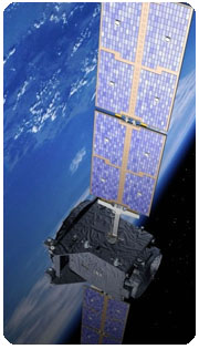
GOS satellite in orgit. ![]()
In other words, if a satellite in a geostationary orbit is in a certain place above the earth, it will stay in that same spot above the earth. Its latitude stays at zero and its longitude remains constant. In contrast to geostationary orbits, Medium Earth Orbit and Low Earth Orbit satellites constantly change their positions in relation to the surface of the earth. A single geostationary satellite will provide coverage over about 40 percent of the planet. Geostationary satellites are commonly used for communications and weather-observation. The typical service life expectancy of a geostationary satellite is ten to fifteen years. Because geostationary satellites circle the earth at the equator, they are not able to provide coverage at the Northernmost and Southernmost latitudes. Geostationary orbits are often referred to as geosynchronous or just GEO.
A geostationary satellite is an earth-orbiting satellite, placed at an altitude of approximately 35,800 kilometers (22,300 miles) directly over the equator, that revolves in the same direction the earth rotates (west to east). At this altitude, one orbit takes 24 hours, the same length of time as the earth requires to rotate once on its axis. The term geostationary comes from the fact that such a satellite appears nearly stationary in the sky as seen by a ground-based observer. BGAN, the new global mobile communications network, uses geostationary satellites.
A single geostationary satellite is on a line of sight with about 40 percent of the earth's surface. Three such satellites, each separated by 120 degrees of longitude, can provide coverage of the entire planet, with the exception of small circular regions centered at the north and south geographic poles. A geostationary satellite can be accessed using a directional antenna, usually a small dish, aimed at the spot in the sky where the satellite appears to hover. The principal advantage of this type of satellite is the fact that an earthbound directional antenna can be aimed and then left in position without further adjustment. Another advantage is the fact that because highly directional antennas can be used, interference from surface-based sources, and from other satellites, is minimized.
Geostationary satellites have two major limitations. First, because the orbital zone is an extremely narrow ring in the plane of the equator, the number of satellites that can be maintained in geostationary orbits without mutual conflict (or even collision) is limited. Second, the distance that an electromagnetic (EM) signal must travel to and from a geostationary satellite is a minimum of 71,600 kilometers or 44,600 miles. Thus, a latency of at least 240 milliseconds is introduced when an EM signal, traveling at 300,000 kilometers per second (186,000 miles per second), makes a round trip from the surface to the satellite and back.
There are two other, less serious, problems with geostationary satellites. First, the exact position of a geostationary satellite, relative to the surface, varies slightly over the course of each 24-hour period because of gravitational interaction among the satellite, the earth, the sun, the moon, and the non-terrestrial planets. As observed from the surface, the satellite wanders within a rectangular region in the sky called the box. The box is small, but it limits the sharpness of the directional pattern, and therefore the power gain, that earth-based antennas can be designed to have. Second, there is a dramatic increase in background EM noise when the satellite comes near the sun as observed from a receiving station on the surface, because the sun is a powerful source of EM energy. This effect, known as solar fade, is a problem only within a few days of the equinoxes in late March and late September. Even then, episodes last for only a few minutes and take place only once a day.
In recent years, low earth orbit (LEO) satellite systems have become popular. This type of system employs a fleet or swarm of satellites, each in a polar orbit at an altitude of a few hundred kilometers. Each revolution takes between 90 minutes and a few hours. Over the course of a day, such a satellite comes within range of every point on the earth's surface for a certain period of time. The satellites in a LEO swarm are strategically spaced so that, from any point on the surface, at least one satellite is always on a line of sight. The satellites thus act as moving repeaters in a global cellular network. A LEO satellite system allows the use of simple, non-directional antennas, offers reduced latency, and does not suffer from solar fade. These facts are touted as advantages of LEO systems over geostationary satellites.
More Iridium Satellite Phone related links:
Iridium Frequently Asked Questions - Check the usal questions asked about IridiumIridium Products - Phones, handhelds, docks, internet data sets and accessories.
How iridium phone system works? - A lot of details about Iridium system.
Iridium satellites - Iridium communcation satellites, constellation, flares and more!
Iridium Service - Satellite phone service plans, activation, Internet service
Iridium Phone Rental - Rent or buy? Renting info and companies. Compare prices!
Satellite Phone Blog - Comment the latest news and info from satellite phone arena